Digital QuarryManagementBuilt for Natural Stone
NoriaStrata transforms quarry operations with AI-powered tools that connect extraction, inventory, production, and sales in a single platform. From the quarry face to the client portal — digitized, traceable, and real-time.
Quarry management software digitizes a natural stone quarry from extraction to warehouse, tracking every block in real time. As a complete quarry inventory management platform, NoriaStrata scans blocks with iPhone and iPad LiDAR, records grade and GPS origin, and connects the quarry to sales, so management always knows what was extracted and what is in stock.
Scan a block at the quarry face.Get a complete digital record in minutes.
Point an iPhone or iPad at the block. NoriaStrata captures its geometry with LiDAR to ±2cm, computes the volume, and writes a GPS-tagged, DPP-ready record straight into your inventory — no dedicated scanning hardware, no manual measuring tape.
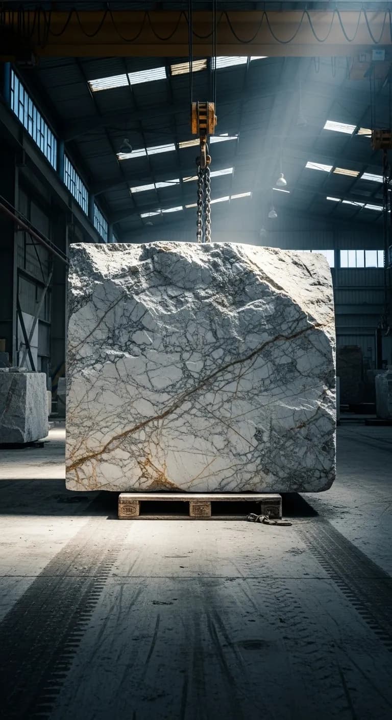
iPhone / iPad LiDAR · ±2cm typical accuracy · ~2 min per block · zero extra hardware
Why Quarries NeedDigital Management
Natural stone quarries are high-value, high-complexity operations running on infrastructure built for a different era. The cost of that gap is measured in lost inventory, missed sales, and decisions made on data that is weeks old.
Paper-based processes lose data
Block records on paper forms get lost, mis-filed, or damaged in quarry conditions. Critical traceability data disappears before it reaches the warehouse.
Manual inventory counts waste time
Counting and measuring hundreds of blocks by hand takes days and introduces errors. Stocktakes become a bottleneck rather than a business tool.
No real-time visibility of extraction
Management has no live view of what was extracted, what grades came out, or how much material is sitting in the yard. Decisions are made on stale data.
Disconnected systems across the chain
The quarry runs on one system, the factory on another, and sales on spreadsheets. Nothing talks to anything. Every handoff creates reconciliation work.
How NoriaStrata Solves It
A unified platform purpose-built for natural stone. Every module connects to the next — no gaps, no exports, no reconciliation.
AI for quarry operations
Every block NoriaStrata scans becomes structured data an AI can act on. AI quarry management means the platform classifies material, predicts demand, and guides allocation automatically — the intelligence layer generic ERPs and spreadsheets simply do not have.
AI material classification
NoriaStrata's AI detects and classifies quarry material the moment a block is scanned — stone type, color family, grade, and vein pattern — so nothing depends on manual sorting or an operator's memory.
AI-driven demand and sales
AI-driven analytics forecast demand, surface yield trends, and flag the blocks most likely to sell — turning raw quarry data into stone sales decisions instead of guesswork.
One intelligent system
From extraction to invoice, AI quarry management links scanning, inventory, and allocation into a single platform — the intelligence layer that disconnected ERP and spreadsheet tools cannot match.
From quarry face to inventoryin four steps
Open the NoriaStrata app on your iPhone or iPad
No dedicated scanning hardware needed. The LiDAR sensor is already in your device.
Scan the block at the quarry face
Point the camera at the block. NoriaStrata measures dimensions automatically in approximately 2 minutes per block including photography.
Tag origin zone and grade
Assign the block to an extraction zone, enter grade classification, add notes. Fully offline-capable — syncs when you have signal.
Block appears in your inventory instantly
The block is live in your warehouse inventory with its full record. Search it, allocate it, sell it.
NoriaStrata vs Generic ERP
Generic mining software handles aggregate and crushing. Generic ERP handles accounting. Neither was built for natural stone. NoriaStrata was.
Built for natural stone — not aggregate
Every feature is designed for marble, granite, travertine, and cut stone. Not crushing plants. Not aggregate. The workflows, terminology, and data model match how stone businesses actually operate.
iPhone/iPad LiDAR — zero extra hardware
NoriaStrata uses the LiDAR sensor already built into iPhone 12 Pro+ and iPad Pro (2020+). If your team carries iPhones, you already own the scanning hardware.
16 integrated modules in one platform
Extraction, inventory, production, logistics, CRM, analytics, portal, and more — all connected. No middleware, no integrations to maintain, no piecemeal tools.
Available in 5 languages
Full platform in English, Greek, Spanish, Italian, and Turkish. Built for international stone operations and multinational teams.
EU Digital Product Passport ready
Every LiDAR scan creates a DPP-ready record with GPS origin, dimensions, and chain-of-custody. Built for the 2027-2028 EU construction material requirements.
Feature comparison
Quarry inventory management
Quarry inventory management is the real-time tracking of extracted stone — blocks, slabs, and processed material — from the quarry face through processing to sale. Each block is recorded with its dimensions, GPS extraction zone, grade, and photos, then followed through every status change: in stock, allocated, cut, sold.
Done digitally, it replaces manual counts and spreadsheet reconciliation with a live ledger of what the quarry actually holds, where it is, and what it is worth — the same data spine that feeds the inventory tracking for stone downstream at the slab yard.
Frequently asked questions
Ready to Digitize Your Quarry?
See how NoriaStrata connects extraction, inventory, production, and sales — using the iPhone already in your team's pocket.
Guided onboarding · Live in days, not months